Itchy Boots
I have been following the YouTube channel Itchy Boots about the travels of Noraly for some months and I also started to track her biking routes
in Google Earth and recording them in a KML file. She posts her videos on Sundays and Wednesdays. She just
announced that they will be posted on Sundays only for the coming time. I
guess that there are some troubles with the planning of her trip for the coming
season. The videos she puts on are from a trip she made around August and
September 2025. I am using Google My
Maps to generate most of the tracks. It has an option to export tracks
as KML/KMZ files. Her videos only cover short parts of her biking trips and it
is not always possible to establish which route she took exactly. The current
videos are about traveling throught China, which have complicated things a bit.
On January 25, I already wrote about a program
that I use to correct for the offset between the roads and the satelite images.
For all the Chinese text, I have been using the Google Translate option for
translating texts on images. I have been using the Chinese amap.com for finding locations with Chinese texts. It does not always
works well, because signs on shops and restaurants usually do not contain
names, but just state the type of shop it is. You can search for hotels, shops,
and hospitals for example, just like with Google Maps. I also have not figures
out if amap.com has an English mode and if so, how to enable it. The roads in
Google Maps within China are often outdated or contain errors, causing it to
generate incorrect routes, which require some editing in Google Earth. In the
video of last Sunday, Heading deeper into the land of the DRAGON (unseen China) |S8, EP124, she
and mister Bing, her (manditory) guide for traveling within Xinjiang, visit the shop (selling pig meat) of his grandfather-in-law
because it happened to be along the route. The fragment starts at 6:39. Yesterday evening, I already spend a long time geolocating it,
assuming that it was within the city limits of Hami, a large city along the route. According to the sign at the start of
the road they enter, it must be near a hospital, because the sign talks about
the area being a temporary parking locations for a hospital. I search for
locations near hospitals and also for locations near "pig meat shops", but
failed to find it. This evening, I discovered a location matching that is
actually a bit to the west of the city in a small town. I also succeeded in
finding the hotel they stayed at the end of the trip and the 'shopping' center
with traditional Chinese looking buildings in the city of Balikun/Barköl,
which is in Barkol Kazakh Autonomous County. I felt that Bing maps had
beter satelite images for the city. The map in OpenStreetMap shows most of the roads, but only a few buildings, however,
it does indicate the location of the remaining old city walls, which are not
marked on any of the other maps. In other locations, I also saw the, sometimes
barely visible, remanents of the Chinese wall. I have noticed that
OpenStreetMap often does show trails that are not found on online road maps.
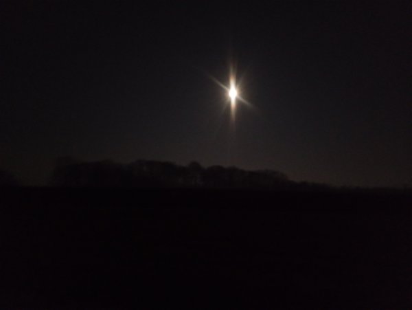
Moon in the sky
This evening, I decided to biked to the care center where Andy lives to attend some meeting because the weather is quite nice with
(near) record temperatures and clear skies. On the way going there, I followed
some sign for the direction of Oldenzaal taking the road called
Oldenzaalseveldweg, which took me into a forrest area (officialy closed after
sunset) and resulted in some detour. The total trip was about 16.4 kilometer
and took me 64 minutes. On the way back, I took a route along the main roads
avoiding some short-cuts, which was about 16.1 kilometer and took me 67
minutes. The road from Losser to Enschede was rather dark except for the light
of the moon, because it does not have street lights except near some road
crossings. At 21:59, I took the picture shown below approximately matching
this Street view
image:
Temperature records
I wrote a program to generate a page with a list of daily temperature records since August 1981 (the
year I came to live in Enschede) as recorded by the nearest official weather
station at Twente Airport based on the file etmgeg_290.zip that can be downloaded from the website of the Royal Netherlands Meteorological Institute. Last Tuesday, the temperature
reached 17.6°C at Twente Airport beating record 17.2°C from 1959 and
today it reached 17.8°C breaking the record 15.6°C from 2013.
19.6° Celsius
The temperature at Twente Airport has gone up to
19.6° Celsius, which breaks the previous record of 18.1°C on this date
in 1989. In the city I saw some magnolia which already started to flower. I
saw some pink and white spots at the top of some of the buds of our magnolia.
Bring Your Own Beamer
From 19:00 till 23:00, I showed my animation at the
Bring Your Own Beamer event at
TETEM art space. This is the third time I
joined this type of event. The previous time was in 2018. This time, I am showing an annimation based on irregular grids of squares and equilateral triangles and street tile patterns (once every four times). For the implementation of
the later, I adapted and earlier program into the program STWangGen.cpp, which outputs all generated states into a
JavaScript file that is used by the random generation function that I
reimplemented in JavaScript from the C program. I also printed a QR code with
the link to the animation and many people used it to view the animations on
their phones. Quite a lot people asked how it worked. I also discovered some
interesting 'analog' effects when unfocussing the projection. The other artist
and/or instalations at this event (if I did not miss one) were:
- VJ Caro who was generating video sequences
from sounds produced by a childrens music toy. Quite interesting.
- treebuddy.online.
- @sefst3f with video
generation based on touching (metal) keys.
- Janine van Veen with a video taken in Iceland.
- Viktoria Gudnadottir with two
recent video projections.
- Arcadans, an interactive installation.
- screenfly.eu.
- Marlies van Grootel
with Liminal
Drift.
- Thymen van Baaren with the
CONSOOM installation.
- Extinguished, a computer game made by a group of students.
- A Child's Escapism, a computer game made by a group of students.
- Mind Your Strawberries by Vale (Instagram) and Nurs
(Instagram), an
instalation processing video from microscope. Quite interestings.
- Art in Nature by Ernst Haeckler by Bart Brinkman an installation to generate AI images with a tablet and
console to control parameters.
- nonon.studio with an installation with
a keyboard and generation of images.
- Jip Huisintveld with a dia slide
show on a beamer.
- A virtual high striker, a Friday afternoon project by some employees of
100% FAT, that projects onto a column
in the middle of the room.
It was an intereting evening with a great variation of installation and
projections.
Everyday Bridges
In the evening, I went to the opening of the exhibition Everyday
Bridges with photographs by Maryam Rostampour at B93. The exhibition is about her project that she did in the past months
where she looked at Enschede through the everyday lives of migrants. I read all
the text with the photographs and I enjoyed talking with several people at the
opening.
The China Labyrinth
In the past days, I worked on a JavaScript implementation of an Exact Cover problem solver, which can be found in the file ExactCover.js. I decided to test it with finding 'compact' solutions for
The China Labyrinth as I did before on March
16, 2019. It generates a new random solution every four seconds.
Today, we made some curly kail and used both
potatoes and about half of celery root. All these ingredients we received from
the harvest of Herenboeren Usseler Es. This was
the last curly kail, the heads of the plants, that we received for this year.
This is the first time that we used celery root. We also added pork and spice
mixture, and at it with gherkins and Rookworst, a type of Dutch sausage that is traditional served with several
types of hotchpotch dishes.
AI Eyes
I went to see the exhibition FAI (Fine Art
intelligence): 'AI Eyes' again, which I briefly visisted on Friday, February 28. It has works by a number of female photographers who
used AI to modify some part of their work. Work from the following photografers
was on display:
- Inez Plezier with installations
about women transforming into ravens, her muse.
- Angela Stouten.
One of the series on display, where portraits from her aangeraakt (Dutch for touched) series along side recreated versions
with the help of AI.
- Imca Schoots.
- Wiranda Lund with a
series that is called (translated to English): Four seasons. Two faces.
One story.
Quite interesting.
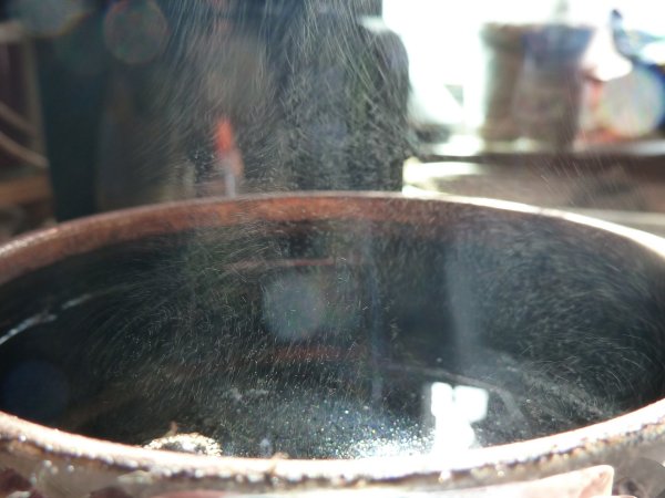
Steam
This morning, when I was waiting for the water in the teapot to get to the
advised temperature for the type of green tea I had selected, I noticed some
steam droplets, typically 3 to 10 μm in diameter, dancing above the
teapot. Below one of the two pictures that I took. These droplets are not
jumping from the boiling water, but are forming just above it due to the colder
air around the teapot causing the water vapour to condense in small droplets.
I guess that the shape of the teapot makes encourages colder air drawn from
the sides due to the upwards flow of heated air with the water vapour.
Dune: Part Three | Official Teaser Trailer
I watched the Official
Teaser Trailer for Dune: Part Three, which is going to be released in nine months and one
day. Although I did not like Dune: Part Two, I think
I am still going to watch Part Three. This visuals, as expected, look good.
Maybe know that Denis Villeneuve does not have the pressure anymore to deliver
a block-buster, like I felt he had for Part Two, that it is going to be less of
an action movie, although I understand that it will still have a lot of action.
In teaser trailer has Paul asking advice with respect to the wars he is
fighting, where Jessica answers: 'Your father did not start a war,' suggesting
that Paul started the Jihad. That is indeed how it is brought in Part Two, but
slightly more different from how it is written in Dune. Paul was not the active source of the Jihad, he was merely the fuse
that caused it. The Fremen were oppressed for centuries and had become, also
under the influence of the Missionaria Protectivia, religious fanatics where the sharing of the
transformed Water of Life in the Sietch or Spice orgy awakening a very strong tribal consciousness. Chani
explains: "When the tribe shares the Water we're together - all os us." (I fear
that the Bene Gesserit where not aware of the explosive situation they had
created with their interference.) Once a messiah appeared to save them, the
transition from oppressed to oppressors was to be expected as we also have seen
in our own world history up to today. Paul tried to avoid the Jihad to happen.
It was in the tent with his mother that he first sensed it as something that
could not be avoided. Yet, he made the decision to revenge the death of this
father. In the first chapter of the second book of Dune, he wishpers "Now
Harkonnen shall kill Harkonnen." He let all opportunities to avoid the Jihad
pass. The last, I think, was when the visited the water basin where the water
from Jamis was left. Paul is aware of the coming Jihad, but does nothing. When
the leave the case he feels that "a vital moment had passed him." He thought he
could take revenge and avoid the Jihad, but in the end he could not and after
being unable to avoid it, embraced it. This often how things happen in life
when people are overcome by evil. Instead of chosing to show the danger of
messianic faiths, Villeneuve chose to make Paul the villian causing the Jihad.
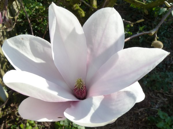
Some flowers opened
Yesterday at the end of the afternoon, I saw that some flowers on our magnolia had opened. Below a picture, I took of one of the flowers.
I also checked the seeds we harvested last
September. One of the two growing boxes had some white mold, probably
saprophytic fungi, which are considered harmless. I did not see any
evelopment, but I assume that it still too early. I will keep an eye on them
and add water if needed.
I finished reading the book Spiritual
Enlightenment - The Damnedest Thing by Jed McKenna, which I started reading
four days ago. Jed Mckenna is a pseudonym of an unknown author. This is the
first of nine books he wrote in total, but I get the impression that the
following eight books do not add much to what he wants to tell. This book
seems to describe a period of at most two weeks where he writes about the
conversations he has with various people in around the house he is staying. It
would not surprise me if it totally fictional but might still be based on
actual conversations. He claims to be enlightened and that he became
enlightened through a process that he calls Spiritual Autolysis, which comes
down to evaluation everything you consider to be true. A long time ago, I
already wrote something about what I think
is true and also about being a sceptic, but the
book did made me think about those things again. Although the author goes to
great length to explain that many traditional sources are not the leading to
enlightment, but to mystism at most, he still primarily quotes from those
sources. He does not mention any recent scientific source about research into
the brain and consciousness. Enjoyable read.
Counting ballots
Yesterday, the 2026 Dutch municipal elections were held and I helped with counting the ballots again. We only had 740 ballots at the polling station
where I helped. We finished counting around 11 in the evening. I stayed
together with the chair until the ballots and the official report were
collected by separate people. We only made one small mistake during the
counting of the ballots, which was corrected by a recount. This afternoon, I
went to the central location where the official reports are checked and decided
if a recount of the ballots is required. Up to now, I had always thought that
everything was recounted. That would indeed require a lot of people. Shortly
after we arrived, we were told to have some patience. Some group of people
started to do some recounts. After about an hour waiting, the project leader
came over and told that there was less recount work than they had counted for
and that we were send home. I felt a bit dissapointed because I came to help
with the recounting, but I did understand that it would be a bit useless if
half of the people had come were waiting for a new recount while the others
were busy. We did collect the chairs and fold the tables before we left. I
decided to go into the city and I saw the exhibition AI Eyes for a third time. Then I saw the exhibition
Pantaleon Hajenius & Haveman-Betman at Beeld & Aambeeld. Pantaleon Hajenius is making art works with objects that he find outside.
Idem et Idem
In the afternoon, I saw the exhibition Idem
et Idem (Latin for 'same and same') at Concordia with works by five AKI students. Works by the following students were on display.
- Mira Nair with some cloth dyed with indigo.
- Nela Ervaar with
ceramic figures and drawings of hybride beings sometimes with undefine or
mixed gender. Quite interesting.
- Bülent Deniz Akbostancı.
- Anne van Rosse Tromp with an installation about communication and fear.
Interesting.
- Kore Danaë Plunkett
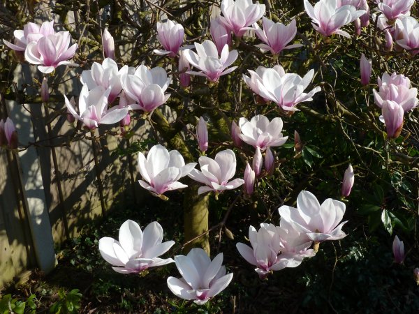
This afternoon, about half of the flowers on our magnolia opened as can be seen in the picture below:
Hail and wet snow
Just before noon, the sky turned dark after the sun was shinning, and shortly
after, hail fell from the sky some of which stayed on the ground. Then the
hail slowly changed into snow with at end even some
real flakes. Soon after a blue sky appeared. Around this time the temperature
at Twente Airport dropped about 5° Celsius.Around two, there was another
similar, but not so strong, hailstorm, which was not followed by snow. At the
end of the afternoon, there was again some wet snow during another shower. We
are a bit worried about the flowers on our magnolia
turning brown, also because the temperature the night is going to drop below
zero.
In the past days, I have been doing some planning for visitings Rotterdam Art Week. I am planning to go there tomorrow and Sunday. I have
bought a pass-partout ticket allowing to visit me all locations that are
require admission. My plan for tomorrow is to visit the following locations:
My plan for Sunday sofar is:
Rotterdam Art Week (Day 2)
There was a broken layer of snow on the ground. At
9:15, I left by train to Rotterdam to visit a number of locations that take
part of Rotterdam Art Week.
Below the works and or artist that I found noteworthy at the various locations
or exhibitions.
Prospects
Xaver Könneker.
Samboleap Tol with Starlight.
Pippilotta Yerna with Please, piece your bones into mine.
Sophie Schreurs.
Alice West.
Marina Sulima with Of Climbing Vines and Copper Crystals.
Natalia Jordanova with Latency Treshold, Latency Echo, Latency Transmission, Latency Amplification, and Latency Resonance.
Suzanne Plomp with Framed in Veins (Substanctia), 2026.
Isamo Thissen with De Melkfabriek,2025 and De Jacht, 2026.
Obbe van der Weide with OS, Enforming, I, II, and III.
Sander Coers with Intensive Care (Pietā), 2026.
Clémence Lollia Hilaire with CRAA.
Maja Simišić with a poster.
Luca Tichelman with All the Wonders and the Ahhhh.
Yara Veloso.
Lea Novi with The Golden Garden.
Ceola Tunstall-Behrens.
Yara Jimmink.
Aaryan Sinha.
Christy Groen with Polyshift Horizon, Polyshift Full Frame, and Polyshift Portrait.
Nelly Dansen with Project XXX.
Steffi Reimers.
mo Futures with Bizarre Beauty.
Jonathan Tang.
Aion Arribas with Dear Rubsters and Scisoring, Rubbing, Dildoing.
Juni Mun.
Saja Amro with Firearms Prohibited.
Bonnie Ogilvie with Pin Me Down,
Madeleine Elisabeth Peccoux with Moonbump, 2022-now.
Sophie Allerding.
Doris Kolpa.
Marlot Meyer with Pneuma, 2025-2026.
Jonathan Hielkema.
Jildau Nijboer with Undercurrent I, 2026.
Maaike Meindertsma with Shortcut.
Ben Yau.
Anto López Espinosa.
Geo Barcan.
Gus Drake with Landscapes in Motion.
Jamal Ageli with Call Her the Morning Star, 2026.
Ariane Toussaint with A Textile Room.
Radvlad with Reduced Artifacts 4×.
Pelle Schilling with a melting metal wire.
Lena Longefay with La Chanson à Boire de la Douleur de la Terre.
Loran van de Wier with Veganistische kaas sculpturen in vitrine.
Katayoon Valamanesh with I Am Not The Girl, I am the Horse, 2025.
Sixin Zeng with The 2.5D Nomad.
Joppe Venema.
Sarjon Azouz.
Frances Rompas with The Exotic Fruit Section.
Art Rotterdam
- Enchanted Land XVI, Enchanted Land XXIV, and Enchanted
Land XV, Imran Channa, 2026.
- Rhythm of Color by Marian Bijlenga, 2022.
- Aperture,
Patric Bergsma, 2026
- The Collection of Movement, Rademakers Gallery.
- Form.photography, Ksenia
Malafeerai.
- Karacabey, Great Oak, Bülent Özgören, 2016.
- Waanplekken 107, Vivian Ammerlaan, 2025
- Andrea Luzi.
- Baseera Khan.
- Ren Hang.
- Lin Zhipeng (林志鹏), aka No.223.
- Hanging, Carlos Sagrera, 2026.
- Arcades,
Stefan Curcilic, 2025.
- Queen Beatrix of the Netherlands for Reigning Queen (Royal
Edition), Screenpint diamond dust on Lenox Museum Board, Edition of
30, Andy Warhol, 1985.
- Variatie op Cirkels no. V, Ad Dekkers, 1966.
- Cirkel en vierkant in overgang, Ad Dekkers, 1968.
- Work bij Jan Schoonhoven.
- Fluid Fingers, Fluid Fingers (Sqaure) and Cascade (chain
reaction), Zoro Feigl, 2025.
- Untitled, Stefan Peters, 2025.
- Rob, Kennedy, Michael Bailey-Gates, 2023.
Cordico
Rotterdam Photo
- Self-Mixing 2.0, Ying-Chen Joyce Lin.
- AION, Radianto.
- Horizontal Rain, Anni Nöps & Casmir Geelhoed.
- Thanks For
Nothing, Kenneth Kong.
- The Self at 50Hz, Omer van Soldt.
- An Archive of the Artic Echoes, Sarah Damai Hoogman.
- Recalibration 00:00:00, Pita Kim Youbin.
- M-PC: My Personal Computer, Marijn Brussel.
- Solid Voids, Robin Beekman.
- Wetware, Anna Bielska.
- Works like magic, Jack Oomes.
- The Human Imposter, Isa Broodman.
- An Amalgaan Loop: Persistent State, Alessio Pinton.
- Prologue, Pip Greenaway.
The Usual
Kunstinstituut Melly
Garage Rotterdam
From the exhibition At the End(s) of the World: The Ground Is Shifting.
- As Gems in Metal: Face 001, Louis Braddock Clarke, 2025.
- A Living..A Killing, Daniel De Paula, 2024.
- Subject..Subjected, Daniel De Paula, 2024.
- La Città de Bolo,
Rä di Martino, 2022.
- Zwei Wölfinnen, Julius von Bismarck, 2023.
- Dead Minutes,
Tom K. Kemp, 2023.
Rotterdam Art Week (Day 4)
I traveled to Rotterdam to visited some locations of the Rotterdam Art Week.
Below the works and/or artists I found noteworthy at the various locations.
At Brutus Art Space, I saw the exhibition Autonomous curated by Ine Gevers. I found the following works noteworthy:
- Video by Stefan Panhans &
Andrea Winkler.
- Way in,
Boukje Schweigman
& Johannes Bellinkx.
- Garden Amidsts the Flame, Natasha Tontey, 2022.
- HEXEN 5.0 (Tarot cards and historical diagrams),
Suzanne Treister, 2025.
- RAPTURE,
Andrea Khóra, 2024.
- Schule der Liebenden (School of Lovers), melanie bonajo, 2024.
- PUK* System,
Floris Schönfeld, 2020/2025.
- From the Society to the Consciousness Industry,
Warren Neidich, 2022.
I also saw the Sanitas Futurum exhibition by Atelier Van Lieshout.
At the Kunst &
Complex building, I visited the studios of the artist. I found the
following noteworthy:
At the Katoenhuis, I saw the
exhibition Observatory: Cosmic Cabinet. I found the following works
noteworthy:
- Lichtspiel: Ars Anaclastica, Experiment Nr. 8, Zalàn Szakács, 2023-ongoing.
- In the Light of Aï Khanoum, Narges Mohammadi, 2026-in-process.
- Binnenweg, Nick Mansveld, 2015.
- Capella, Studio Den Haan, 2023.
- Water Rhythm, Studio Den Haan, 2026-ongoing.
- Lichtspiel: Catoptic Theatre, Zalàn Szakács, 2024.
- New Atlantis, Experiments Nr. 2, Zalàn Szakács, 2025-ongoing.
At the exhibition Haute
Photographie, I liked the following photographs:
- Vigsø, Denmark, Stephan Vanfleteren.
- The Threshold of the Holiest of Holies, Ole Marius Jorgensen, 2024.
- Monkey lady,
Janus van den Eijnden, 2026.
- Dive, Haitsma & Prins, 2023.
- No More!, J.D., 2025.
- "Blur", Deana Nastic, 2022.
- HIDDEN PRESENCE, Irina Ozkul, 2023.
- NAKED INNOCENCE, Irina Ozkul, 2023.
- A time to live -
Equilibrium, Jaap Kloppenburg, 2023.
- Freedom, Mike Steegemans, 2023.
- SURRENDER, Julia Dongstra, 2024.
- LETTING GO, Julia Dongstra, 2025.
- Spiegel im Spiegel, Katiche van de Knoop, 2019.
- LUCID 1:1, Danny Van de Elst, co-created with Luka Zegers, 2025.
- Image of N., Danny Van de Elst, 2024.
- Hijri Bridge -
Tokyo, Jaap Vliegenthart, 2025.
- ALONE | Moray, Leon Bouwman, 2016.
- Kate Moss, Michel Haddi.
- The oldpier,
Janko Bosch, 2026.
- Bakhuizerzand, Harderwijk, Rik Klein Gotink.
- Violence, Ivar Schutte, 2024.
- Veiling I, Ivar Schutte, 2025.
- Nightlife - Jole de
vivre, Esther van der Wallen, 2023.
- UNFOLDING 舒展 - The Shedding, Alaïa Fonk, 2026.
- DON'T HATE THE ARCADE, Noémi Sarpe, 2025.
- Troost #012, Loes Haverhorst, 2025.
- Cockatoo, Anouk De Kleermaeker, 2025
- LIONHEART 5, Double O Roos, 2025.
- We are close, YANi.
- Expectations, Daena Looman & Sophie Jesurun, 2025.
At the Keilewerf, there
were many people outside sitting and eating. I looked around inside and spend
some time at Studio i Focus of Iris Veentjer and watch the machine to spinning machine
for long fibers for the RietGoed project. Quite interesting.
At TEMT, I liked:
At the Museumplein, I saw the exhibition Learn to Love the Bomb
organized by TECART. I found the followings
works noteworthy:
- Everyday Maneuver, Yuan Goang-Ming, 2018.
- Warnings in Waiting, Aura Satz, 2025.
- Everyday War, Yuan Goang-Ming, 2024.
- AI War Cloud Database, Sarah Ciston, 2025.
- In 36,000 ways, Karim Ben Khelifa, 2025.
- The Voyeur of
Utter Destruction (As Beauty), WERC, 2025.
- DeathTolls Experience, Ali Eslami, 2016.
At Kunsthal, I first saw
the exhibition What the Hell Was I Thinking by David Shrigley. I found the following noteworthy:
- Extractors, 2018.
- Horseshoe Made From a Meteorite, 2008.
- Subtractor, 2013.
- Fluff Wat, 2019 (2025).
- Life Model III, 2025.
- Clock, 2021.
- I Love Grids from Drawings, 2025.
I walked quickly through the exhibition Flowers Forever (because I was becoming a bit saturated with
impressions) and only stopped looking at:
I walked through the exhibition Mr. Goodman: The Kiteman. From the
exhibition They have always been here by Kudzanai-Violet Hwami (Instagram), I liked:
- Kupeta III, 2025.
- Kupeta II, 2025.
- Animus, 2025.
- Anima, 2025.
At the S/ASH GALLERY, I
saw the exhibition
Interface. I found the following installation noteworthy:
This months interesting links
Home
| February 2026
| April 2026


